I.T. Transport
Building transport systems with state of art technology
Building transport systems with state of art technology
We are skilled in developing performance systems, GIS-based road management systems and the use of modern data collection techniques.

Our proficiency in the development of Performance Systems aids governments and transport authorities in optimising road networks and maximising their impact. At IT Transport, we customise performance systems to clients’ needs by selecting key performance indicators (KPIs) and employing modern data collection techniques like automated vehicle location (AVL) systems and traffic sensors. We integrate Geographic Information Systems (GIS) to map performance data and visualise trends, facilitating problem identification and improvement prioritisation.
Traditional road management often lacks quantifiable performance data, necessitating effective performance systems. They offer advantages such as data-driven decision-making, optimised resource allocation, and improved accountability. Beyond data collection, we assist in translating insights into action by benchmarking performance, setting achievable targets, and effectively communicating results. Investing in performance systems yields numerous benefits, including improved road network efficiency, reduced transportation costs, enhanced safety, and increased public confidence in transport authorities. We prioritise a client-centric approach, leveraging cutting-edge technology and focusing on sustainability to deliver comprehensive performance systems. Our expertise in transport engineering, data analysis, and GIS technology ensures tailored solutions aligned with clients’ goals. Through collaboration, innovation, and a focus on sustainability, we empower clients to achieve optimal performance from their road networks.

At IT Transport, effective road management is paramount for a well-functioning transport network, and our expertise lies in Developing GIS-Based Road Management Systems. Leveraging Geographic Information Systems (GIS) technology, we create digital tools that streamline road management decisions, enhance efficiency, and prolong infrastructure lifespan. Investing in GIS-based road management systems yields substantial benefits, including reduced maintenance costs, improved road safety, and enhanced decision-making, as proactive maintenance prevents road deterioration and data-driven decisions contribute to safer roads and more efficient resource allocation.
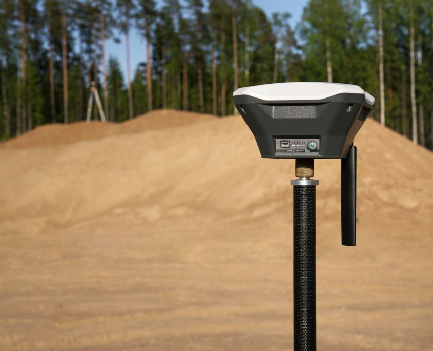
Traditional practices often rely on paper-based records and fragmented data, whereas GIS-based systems offer centralised data management, enhanced visualisation, and improved decision-making. Our approach involves custom development tailored to specific needs, integrating existing road data from various sources into a centralised GIS platform for comprehensive data management. Advanced spatial analysis tools are employed to identify trends and patterns in road conditions, informing predictive maintenance strategies. Additionally, we facilitate mobile data collection using GPS-equipped devices, allowing real-time data collection on road conditions and maintenance activities. These GIS-based systems empower stakeholders to prioritise maintenance activities, predict road deterioration, and improve budgeting and resource allocation by objectively identifying maintenance needs and cost implications.

We recognise the transformative potential of data in optimising transportation systems and leveraging Modern Data Collection Techniques to gather comprehensive insights into road usage, traffic flow, and infrastructure condition. Our expertise in Modern Data Collection encompasses a range of techniques tailored to specific needs, from Automatic Vehicle Location (AVL) Systems for real-time vehicle tracking to Traffic Sensor Technology for monitoring traffic volume and speed.
These techniques offer several advantages over traditional methods, including real-time data acquisition, granular data collection, and improved data quality, enabling stakeholders to proactively respond to congestion and maintenance needs. Additionally, Mobile Data Collection using GPS-equipped devices enables field personnel to gather real-time data on road conditions and maintenance activities, while Remote Sensing technologies like LiDAR create detailed 3D models for comprehensive infrastructure assessment.
Beyond data collection, we transform raw data into actionable insights through integration, analysis, and visualisation. By integrating data from various sources and employing advanced analytics tools, we uncover trends, patterns, and correlations within the data, enabling predictive analytics for forecasting future traffic patterns and infrastructure deterioration. Clear, easy-to-understand data visualisation and reporting empower stakeholders to make informed decisions about transportation planning and management.
Investing in modern Data Collection Techniques offers numerous benefits, including improved traffic management, optimised infrastructure investment, enhanced road safety, and sustainable transport planning. By harnessing the power of data, we drive efficiency, effectiveness, and environmental responsibility in transportation systems, paving the way for smarter and more sustainable mobility solutions.

 Detailed Designs and Technical Specifications